
Directions to Alamo Lake State Park~35 miles north of Wenden, AZ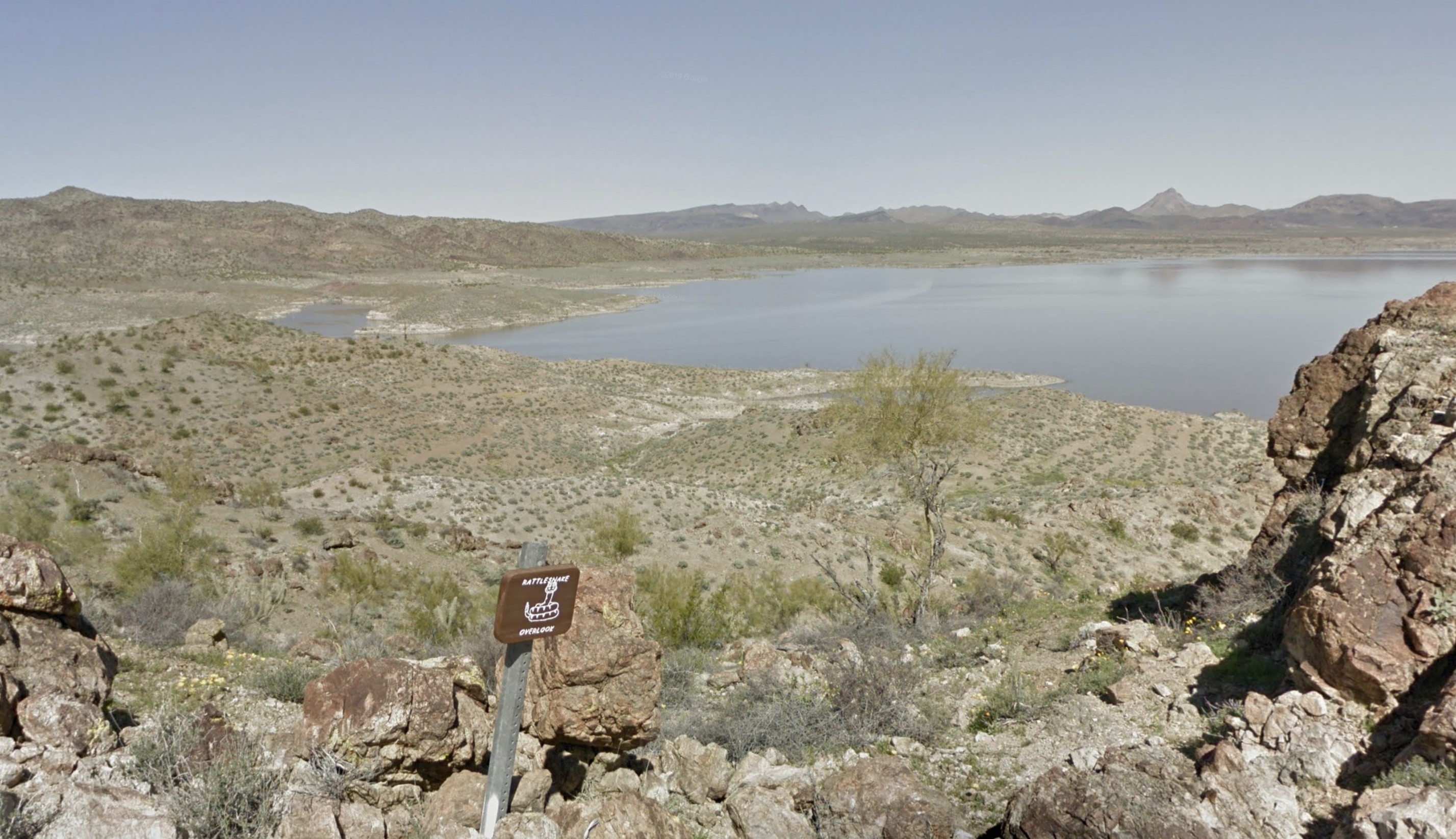
|
|
Alamo Lake State Park is located in a remote area of Central Arizona approximately 2.5 hours west of the Phoenix metro area. Temperatures in early November and late April rise above 80F. Nighttime temperatures at the same time drop into the 40's. Summer temperatures exceed 100F during the day. The desert vegetation surrounding the lake is sparse. Orienteering courses set around Alamo Lake take advantage of the very runnable terrain. The lake is quite popular for fishing, while the distance from major population centers makes the area excellent for nighttime star gazing. We hope you'll join us for events we offer at the lake. DirectionsAlamo Lake State park is located ~35 miles north of Wenden, AZ. The directions here guide you to the Alamo Lake State Park Visitor's Center. The park has a number of different start locations. See individual event details for further information. To get to the Alamo Lake State Park Visitor's Center from Phoenix:
|
Maps
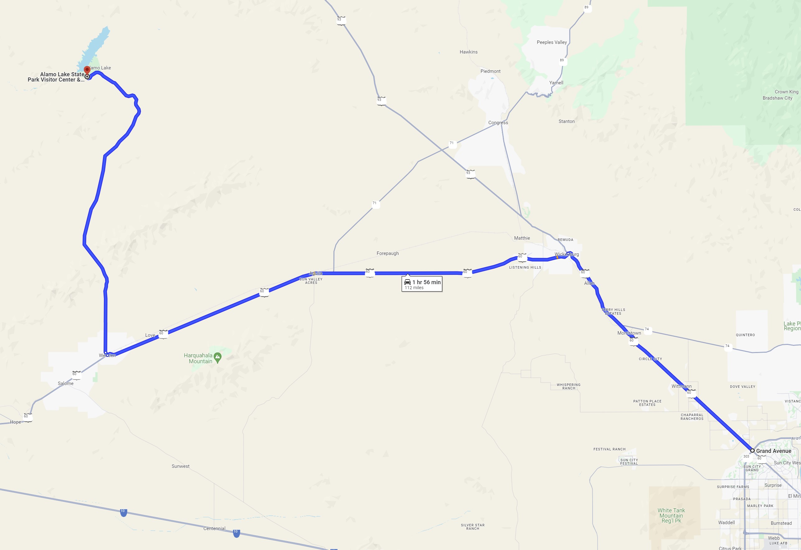
Click on a map below to open an equivalent Google map in a separate window.| From the US-60/Loop-303 Intersection in Surprise, AZ |
|
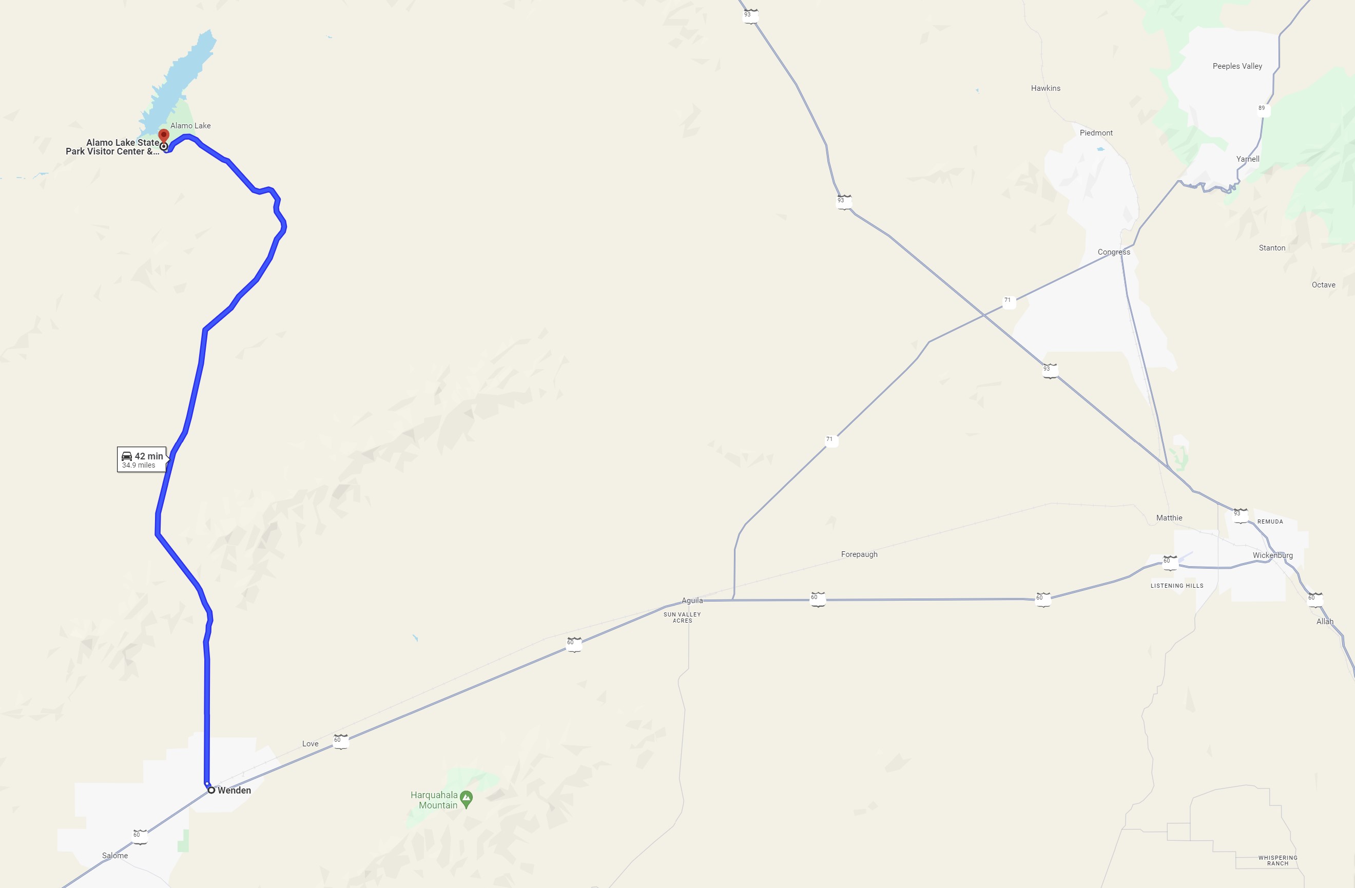
| Directions from Wenden |
|
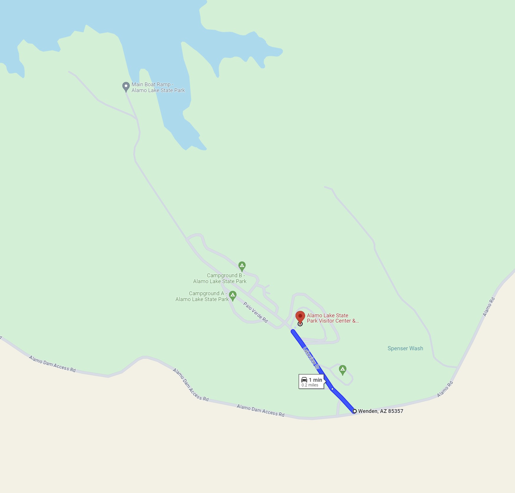
| Directions to the Visitor's Center |
|