Butcher Jones
Recreation Area, North Side of Saguaro Lake
![[image:O flag]](../Images/Map_pin_icon.png) Google Map Placemark
Google Map Placemark
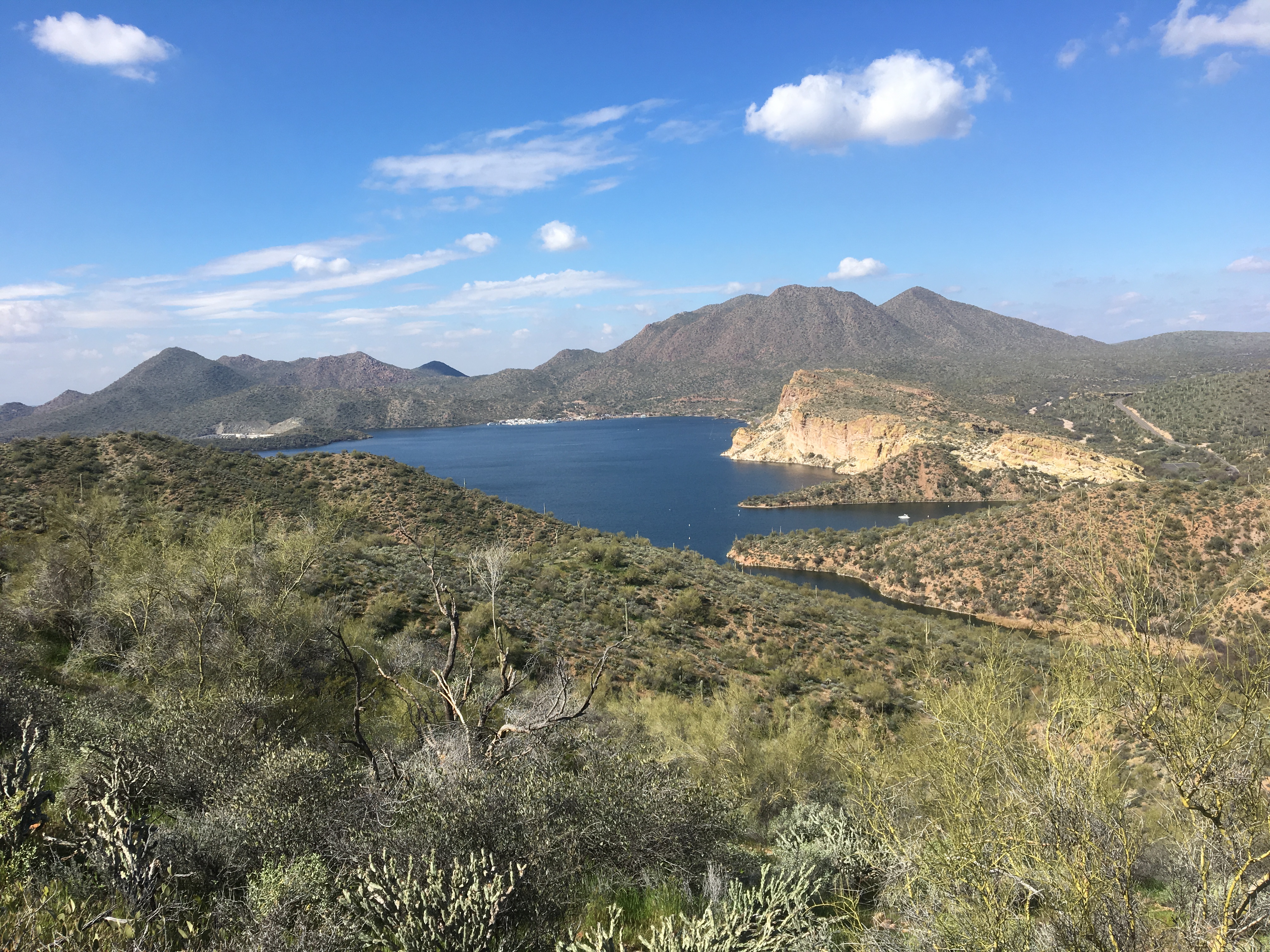
The Butcher Jones Recreation Area is located at a very scenic site on the north side of Saguaro Lake. The site includes rugged hills and cliffs overlooking Saguaro Lake. With abundant water nearby, the desert vegetation is sometimes thick. Views of the lake and surrounding mountains are incredible.
Directions
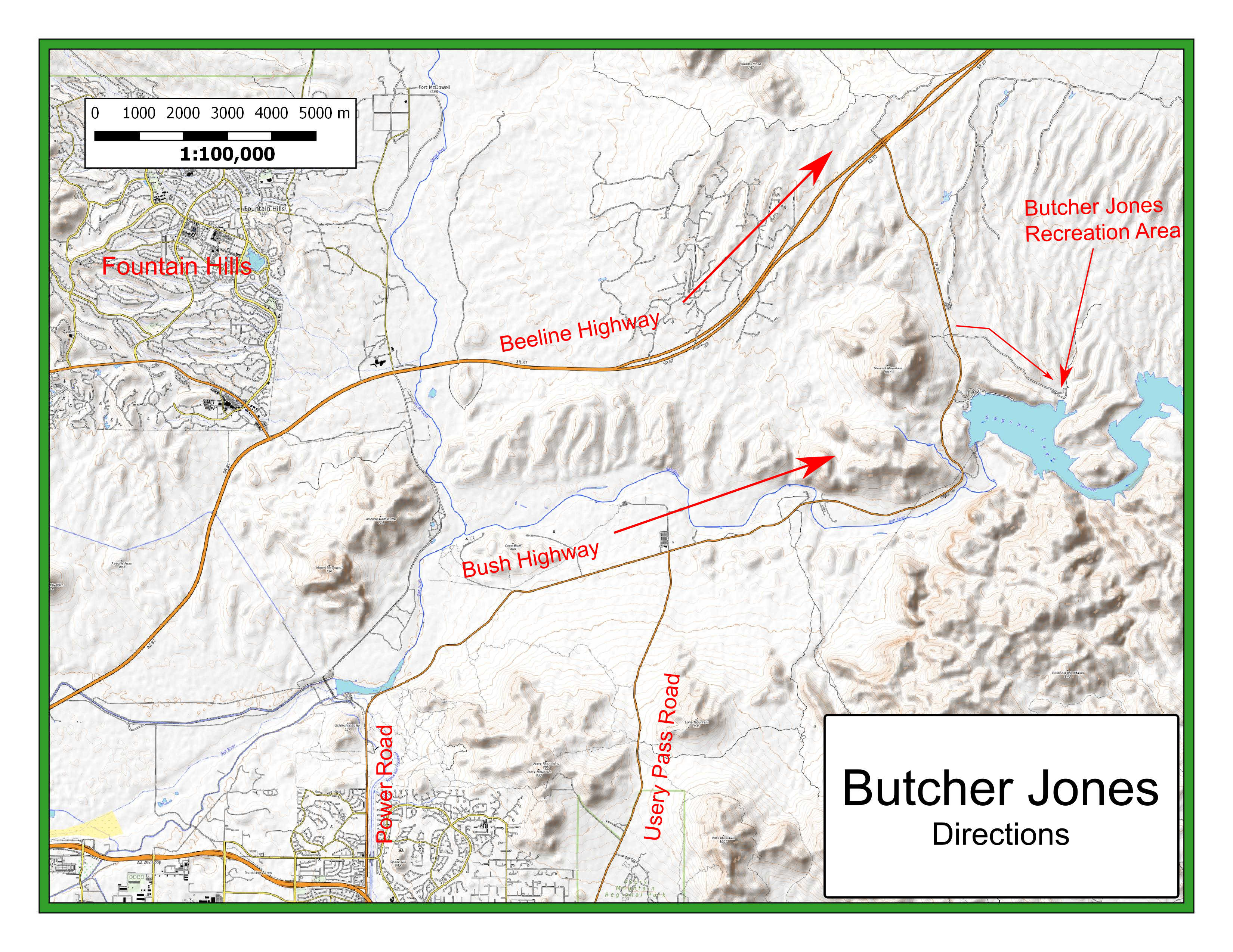
There are two routes to get to the Butcher Jones event site: the Beeline Highway (AZ 87) and the Bush Highway. The Beeline Hwy is 4 lanes and more direct but is not very scenic. The Bush Hwy is 2 lanes and winding with incredible scenery once you get past north Mesa.
- Via the Beeline Highway (AZ 87)
-
From the Loop 202 and Country Club (exit 13), go northeast on the Beeline Highway for 22 miles to exit 199, the "Saguaro Lake, Lower Salt River Recreation Area" exit. After exiting the Beeline Highway, turn south and travel 2.9 miles to the Butcher Jones Road turnoff. Turn east on Butcher Jones Road and travel 2.1 miles to the event site. Look for an orange and white orienteering "sandwich board" at our event headquarters.
- Via the Bush Highway
-
From Loop 202 McDowell Road exit, travel west 0.5 miles on McDowell Road, then continue north on Power Road and east on the Bush Highway for 14.8 miles to the "Butcher Jones Road turnoff. Turn east on Butcher Jones Road and travel 2.1 miles to the event site.
Maps
Click on a map below to open an equivalent Google map in a separate window.
|