|
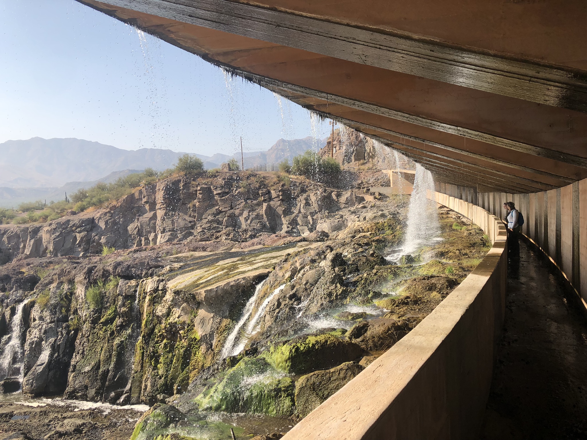
Horseshoe Lake is a gem of a destination in the Phoenix Metro area. The lake is surrounded by rugged mountains, canyons, and desert vistas. As a bonus, the dam itself includes a walkway under the spillway. Visitors can walk under the water flowing out of the dam. The one drawback is the ~8 miles of gravel road that leads to the event site. The road is passable by low-clearance vehicles, but the surface is a bit bumpy. We hope you'll take time out of your busy schedules to join us for some navigation fun in a little-visited corner of the Phoenix area.
|
Directions
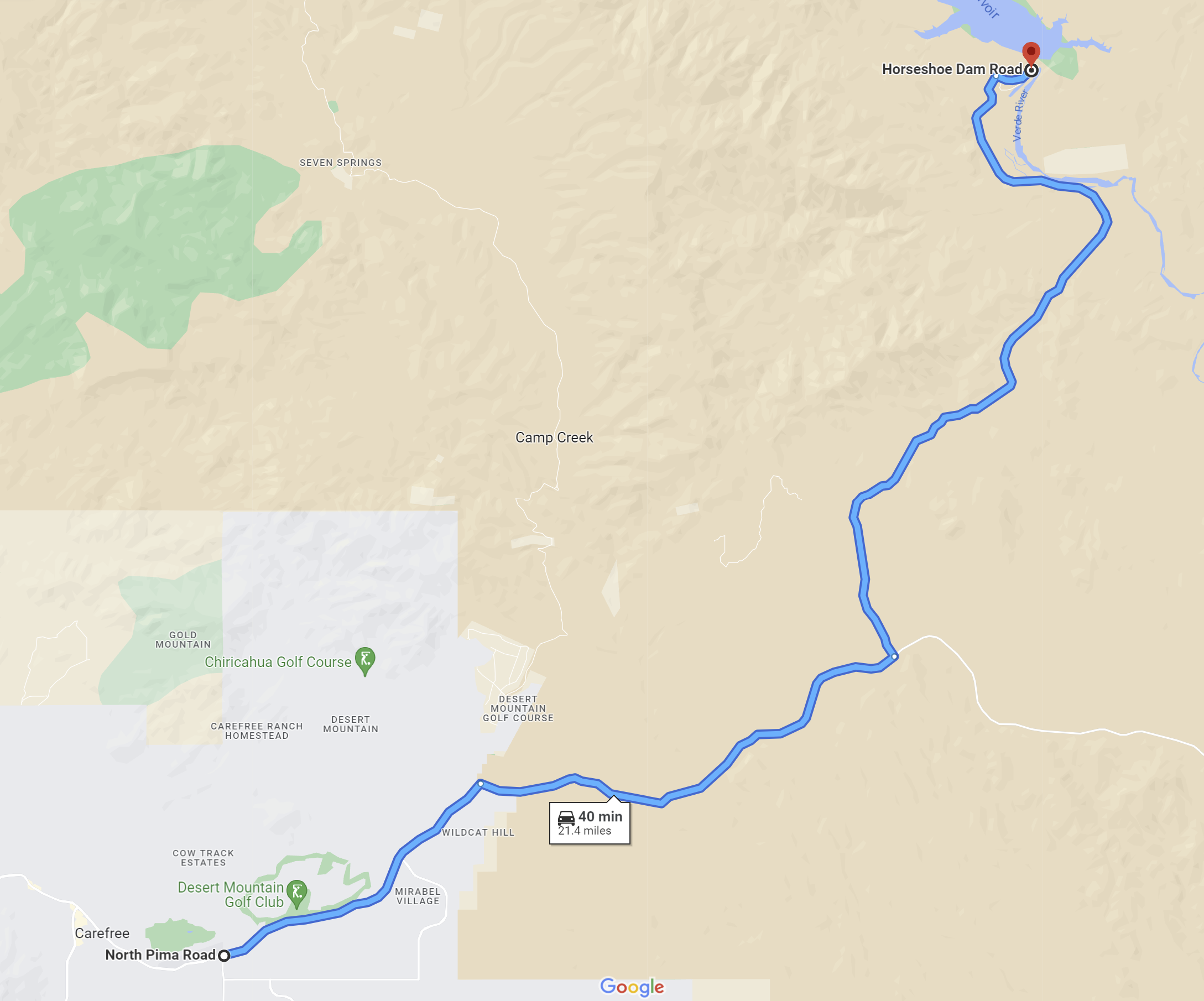
Horseshoe Lake is located in the Tonto National Forest northeast of Carefree, AZ.
To get to the event site:
|
From the Intersection of Pima Road and East Cave Creek Road:
|
-
Travel east on East Cave Creek Road for 4.2 miles to the junction with Bartlett Dam Road.
-
Turn right onto Bartlett Dam Road. Continue east on Bartlett Dam road for 6.3 miles to the junction with Horseshoe Lake Road.
-
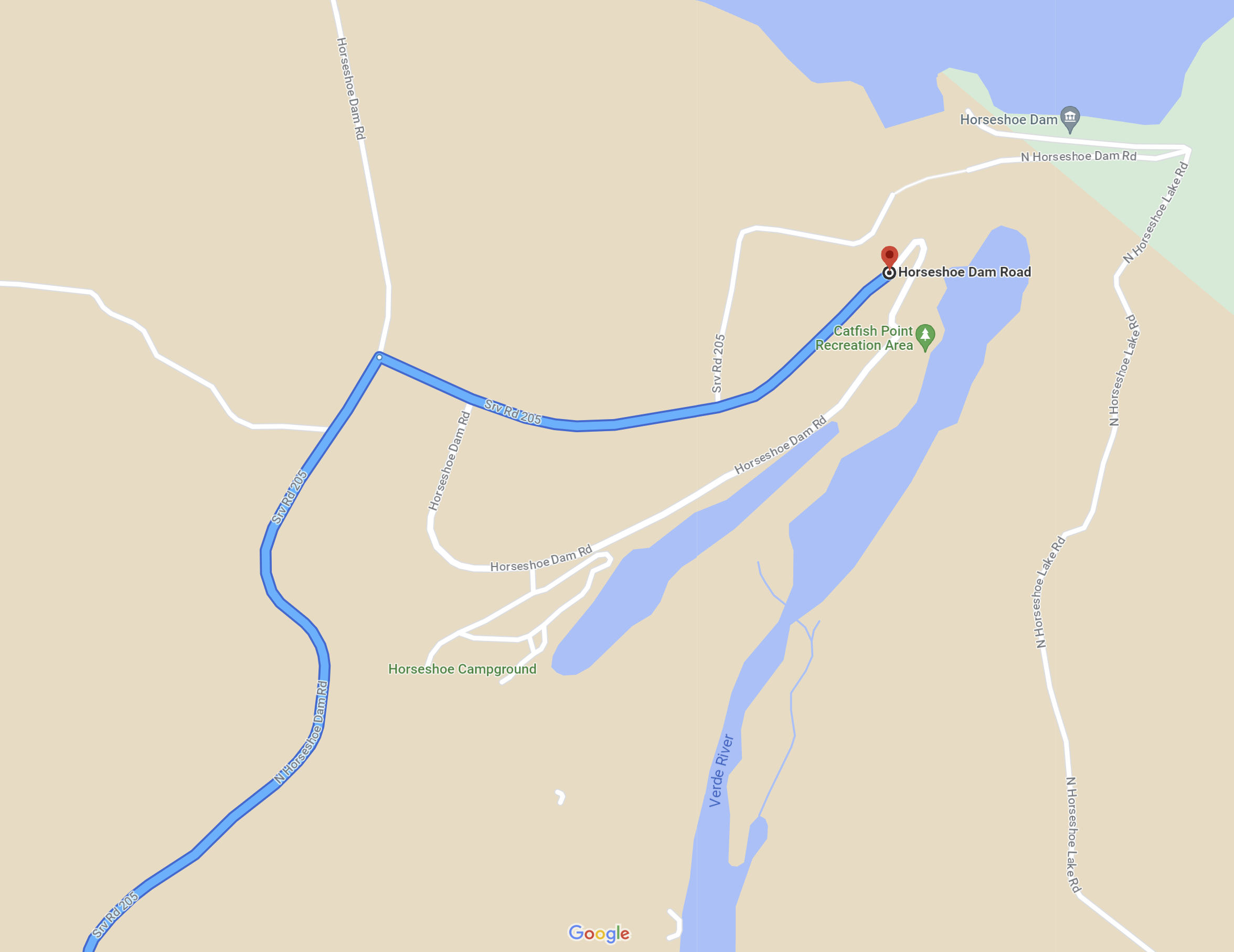
Turn left on Horseshoe Lake Road and travel 10.5 miles to the Horseshoe Lake dam. Horseshoe Lake road is paved for ~2.2 miles traveling north from the intersection. After, a gravel road continues ~8.3 miles to the dam. A sign indicating "Not Recommended for Low Clearance Vehicles" isn't accurate. We've driven the road several times in a Honda Fit, and while the road is bumpy, it is easily passable. At the lake, follow the orange and white orienteering signs to the event start/finish location.
|
Maps
Click on a map below to open an equivalent Google map in a separate window.
|
Map to the Horseshoe Lake Event Site from Carefree, AZ
|
|
|
Close-Up of the Horseshoe Lake Area
|
|
|