|
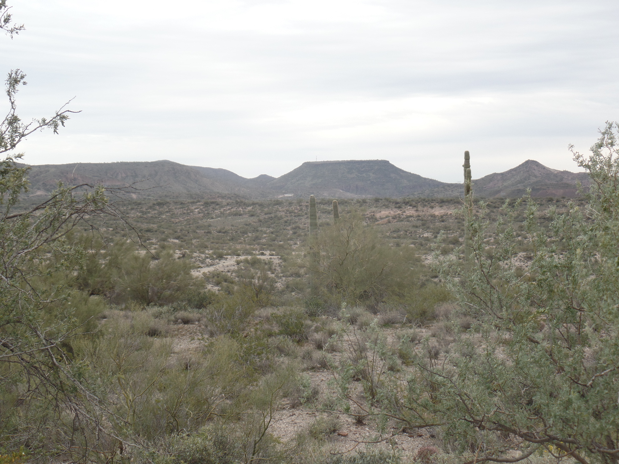
The Little Pan event site is located in the rugged desert surrounding the Agua Fria River and the Black Canyon. With rocky hills and cliffs leading down to the river, the thicker desert vegetation of the area presents particular challenges to participants. The views throughout are spectacular; be sure to bring your camera. Registration for our orienteering events takes place at the Little Pan Staging Area.
|
Directions
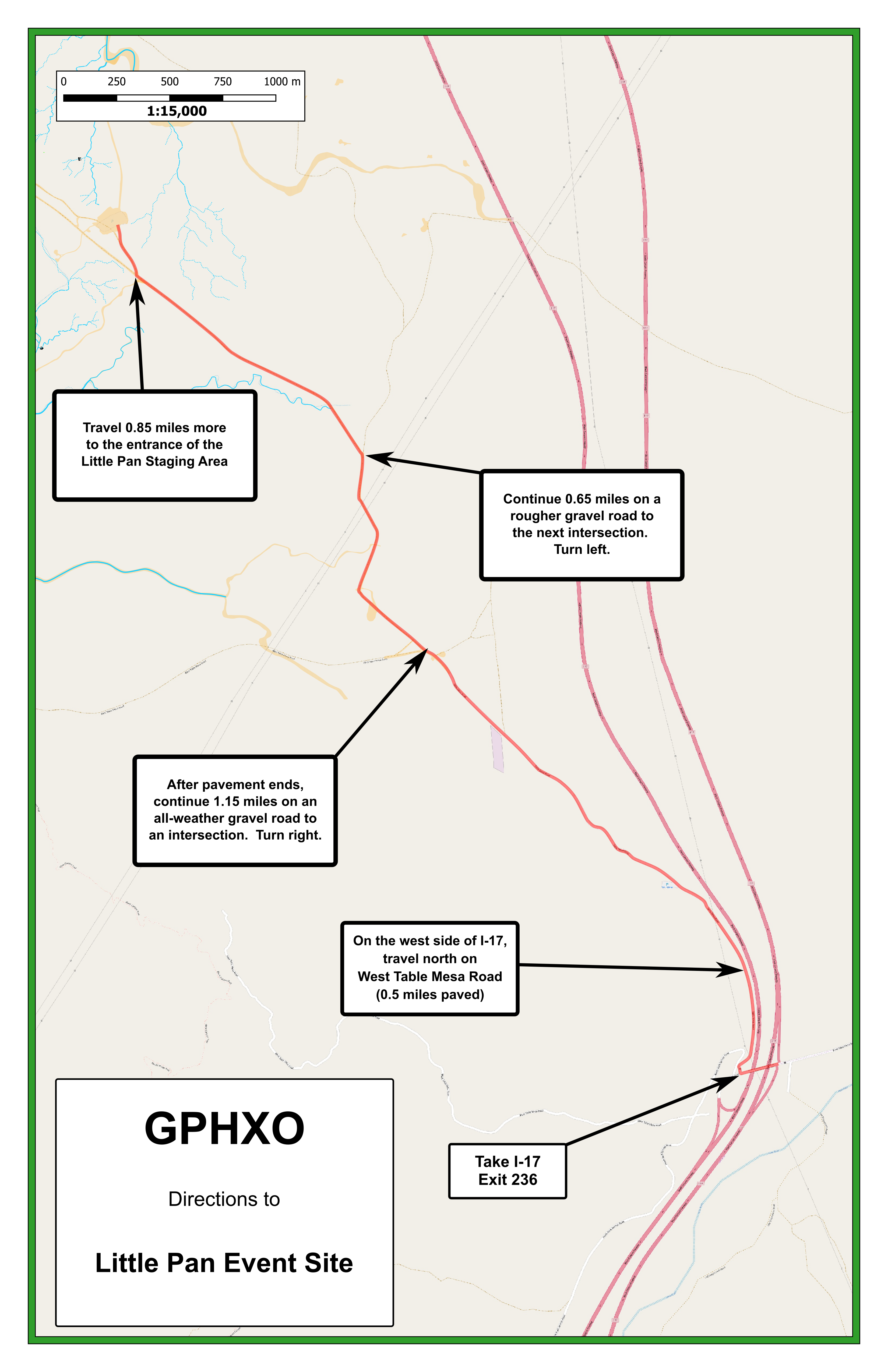
Begin the trip to our Little Pan event site by traveling on I-17 to exit 236 (approximately 5 miles north of New River, AZ). From exit 236, follow the instructions below to get to the event site.
GoogleMap Custom Directions:
|
-
Click here to open a browser window to a Google Maps webpage with a marker at the Little Pan Staging Area.
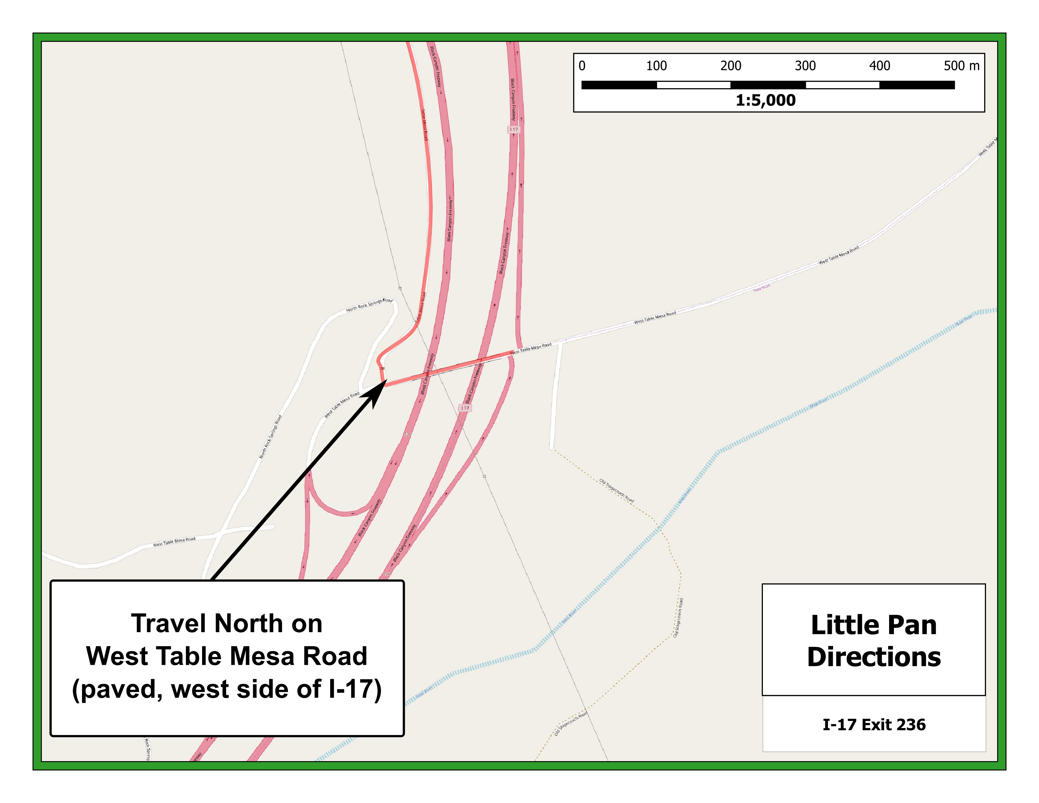
To get to the Little Pan Staging Area from I-17 exit 236:
-
Starting on the west side of I-17 (exit 236), travel north approximately 0.5 miles on the paved West Table Mesa Road. The pavement ends at this point.
-
Continue north on an all-weather gravel road for another 1.15 miles to an intersection. Take the right fork at the intersection.
-
Continue north another 0.65 miles on a slightly rougher gravel road to a second intersection. Take the left fork at this intersection.
-
Travel northwest approximately 0.85 miles further to the entrance to the Little Pan Staging Area.
|
Maps
Click on a map below to open an equivalent Google map in a separate window.
|
View of I-17 Exit 236
|
|
|
From I-17 Exit 236 to Little Pan Staging Area
|
|