|
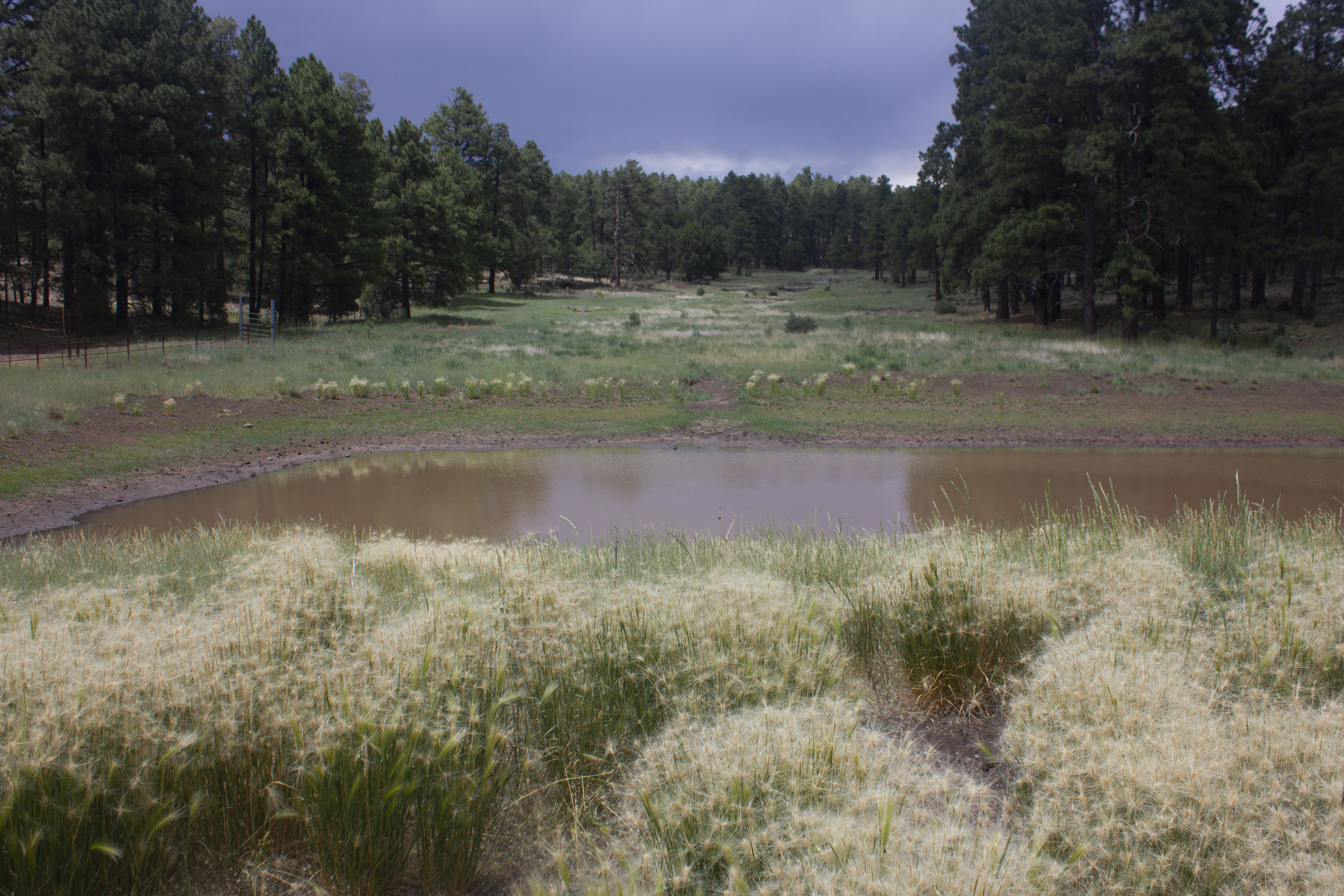
Mingus Meadows is located just west of the Mingus Mountain summit on highway AZ-89A, west of Cottonwood and east of Prescott. At an elevation just over 7000 feet, the event site has relatively cool temperatures in the summer. The terrain is open pine/juniper/oak woodland with occasional meadows. The area is generally a high-elevation plateau with some jeep trails but very few foot trails. We hope you'll enjoy another mountain getaway for your navigation fun.
|
|
Parking is limited. If the parking area is full, the US Forest Service has requested that participants park at the large parking lot for the Mingus Summit Rest Area / Picnic Site along 89A and walk a quarter mile to the staging site.
|
Note: An additional start/finish location is at the Woodchute Wilderness Trailhead. The trailhead is 0.7 miles further northwest along the gravel road.
|
Directions from Phoenix
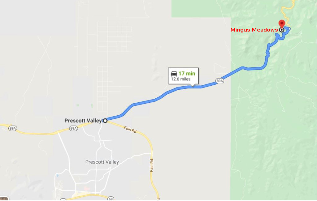
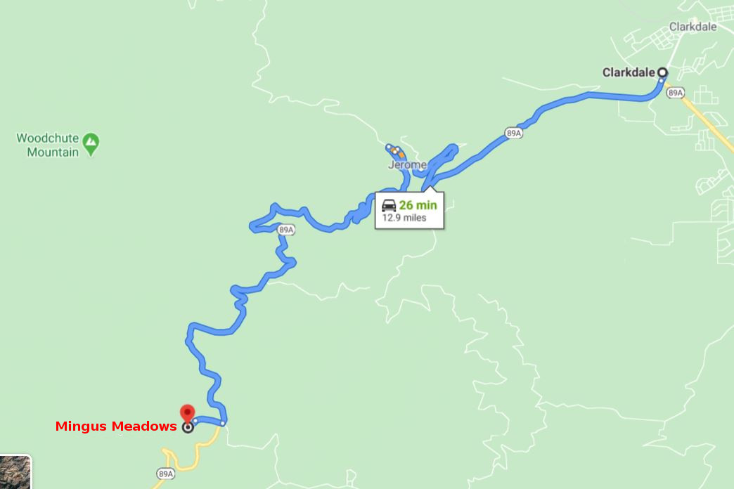
The Mingus Meadows event site is approximately 13 miles east of the Prescott, AZ airport on AZ-89A-N. It is also approximately 13 miles west of Cottonwood/Clarkdale, AZ on AZ-89A-S.
To get to the event site:
|
From Phoenix:
|
-
Follow I-17 N for about 60 miles to AZ-69-N in Cordes Lakes. Take exit 262.
-
Continue onto AZ-69-N for 20.2 miles.
-
Turn right onto Fain Rd and continue for 7.2 miles.
-
Take a sharp right onto AZ-89A-N and continue for 12.1 increasingly squiggly miles.
-
Turn left at the Mingus Mountain summit and continue for about a quarter mile.
-
Just before the gate for Potato Patch Campground turn left.
-
Continue for 0.1 miles to the end of the pavement.
-
The gravel parking area here is the staging area for Mingus Meadows.
|
|
From Cottonwood:
|
-
Follow AZ-89A-S out of Cottonwood through five traffic circles.
-
Take the third exit out of the traffic circle toward Jerome.
-
Continue 4.7 miles to Jerome and pass through town.
-
Continue another 7.6 squiggly miles along AZ-89A-S.
-
Turn right at the Mingus Mountain summit and continue for about a quarter mile.
-
Just before the gate for Potato Patch Campground turn left.
-
Continue for 0.1 miles to the end of the pavement.
-
The gravel parking area here is the staging area for Mingus Meadows.
|
![[image:O flag]](../Images/Directions.png) Google Map Directions from Phoenix
Google Map Directions from Phoenix
Google Map Directions from Cottonwood
![[image:O flag]](../Images/Map_pin_icon.png) Google Map Placemark
Google Map Placemark
|
Maps
Click on a map below to open an equivalent Google map in a separate window.
|
From just East of Prescott Airport
|
|
|
From Cottonwood/Clarkdale, AZ
|
|
|