The Rolls
~5 miles Northeast of the Beeline Highway/Bush Highway Junction
![[image:O flag]](../Images/Map_pin_icon.png) Google Map Placemark
Google Map Placemark
![[image:O flag]](../Images/FirstAid.png) Safety Plan
Safety Plan
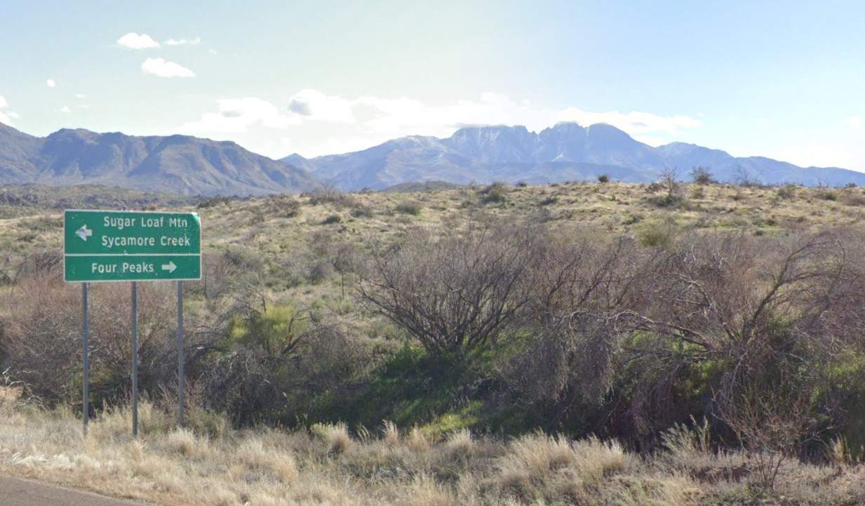
The Rolls event site is another gem of the metro Phoenix area. Tucked under Four Peaks and with views of Weaver's Needle, the Rolls is a scenic showcase of desert terrain. Fires in the last several years have thinned the desert vegetation considerably. The terrain is devoid of the dramatic cliffs found closer to Saguaro Lake. The gentle rolling hills and a network of drainages create considerable navigation challenges. We hope you'll consider joining us for events at this unique area near Phoenix.
Directions
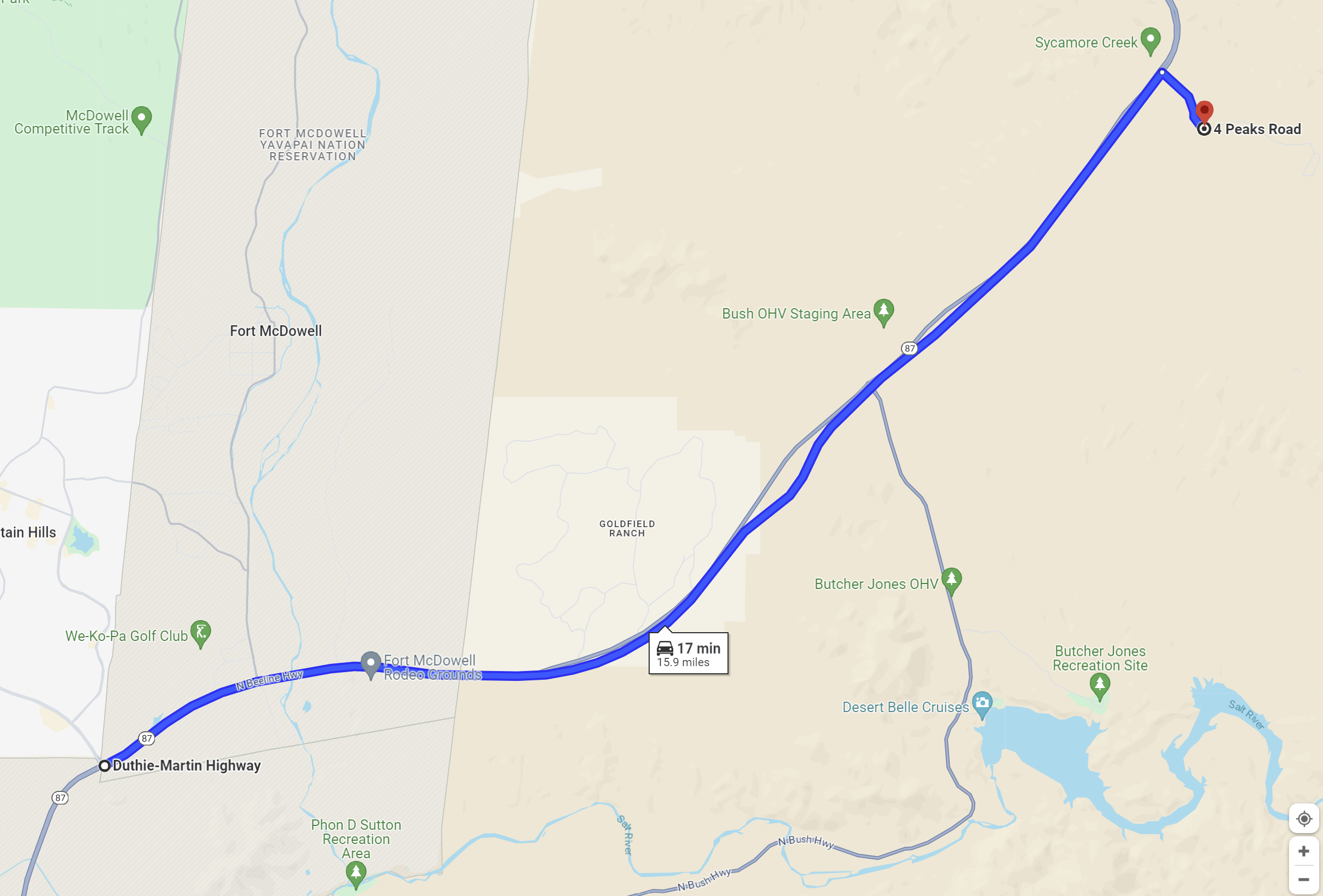
- Via Fountain Hills and AZ 87
-
From the intersection of Shea Boulevard and AZ 87 in Fountain Hills, continue on AZ 87 to the northeast towards Payson for 10.2 miles to the intersection with the Bush Highway, then continue another 4.8 miles to the turnoff for FS143. The road sign here indicates "Four Peaks" to the east. Turn right (east) and travel 0.8 miles to the OHV parking area on the south side of the road. Look for the orange and white orienteering signs.
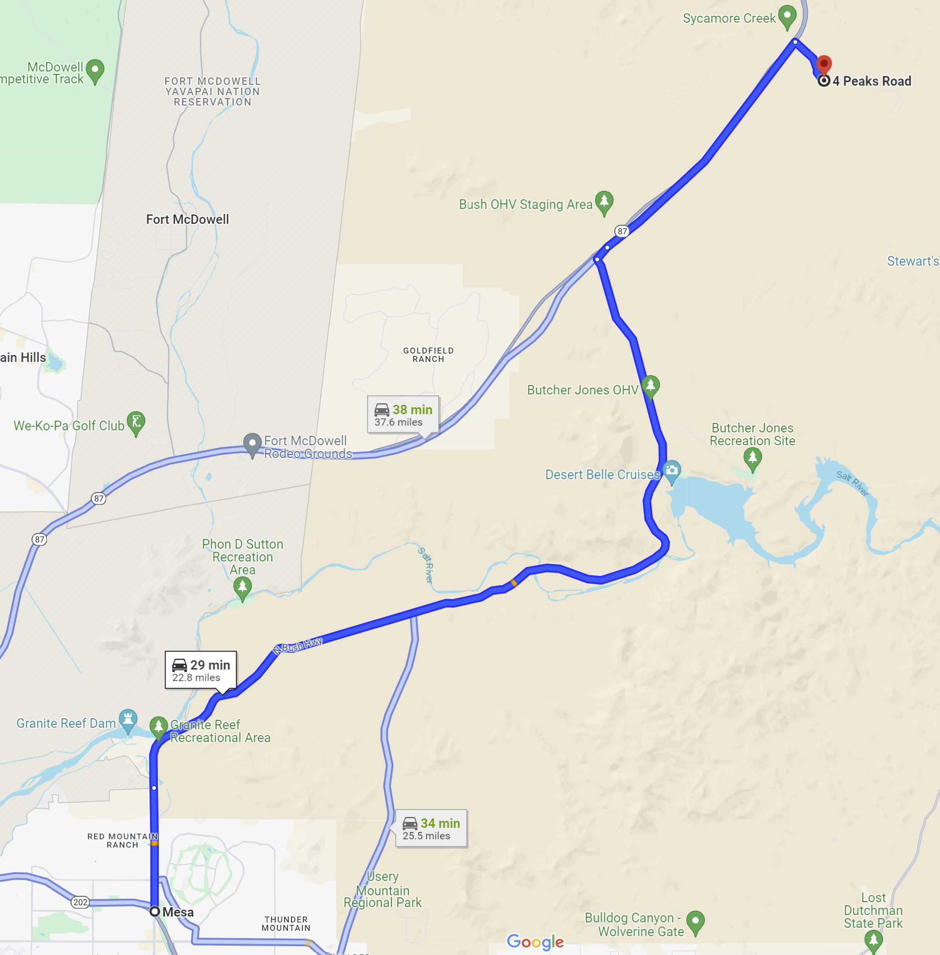
- Via the Bush Highway
-
From Power Road and the Loop 202, travel north and northeast on Power Road and the Bush Highway for 17.2 miles. Power Road eventually turns into the Bush Highway. Once you reach the Beeline Highway (AZ 87), turn right and continue 4.8 miles to the turnoff for FS143. The road sign here indicates "Four Peaks" to the east. Turn right (east) and travel 0.8 miles to the OHV parking area on the south side of the road. Look for the orange and white orienteering signs.
Maps
Click on a map below to open an equivalent Google map in a separate window.
|