|
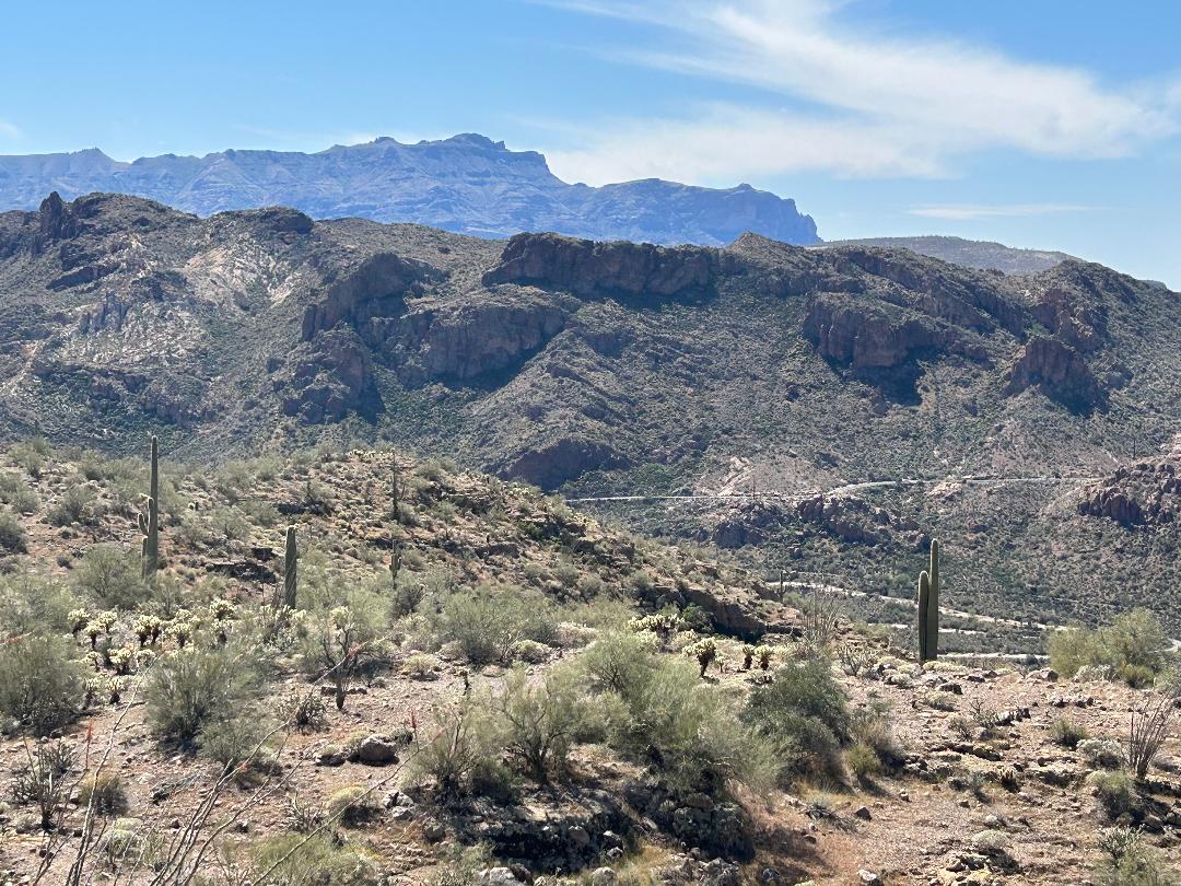
Canyon Lake, northeast of Apache Junction on the Apache Trail (AZ 88), is one of the premier scenic locations in all of Arizona. It is located in a deep canyon created by the Salt River flowing through the Superstition Mountains. The views around the lake are spectacular, with high peaks overlooking steep canyon walls. Due to the rugged terrain, orienteering in the surrounding area is challenging, with routes between points getting blocked by steep climbs or crumbling rock. Be sure to bring a camera to capture the many scenic vistas of the area.
|
Directions
|
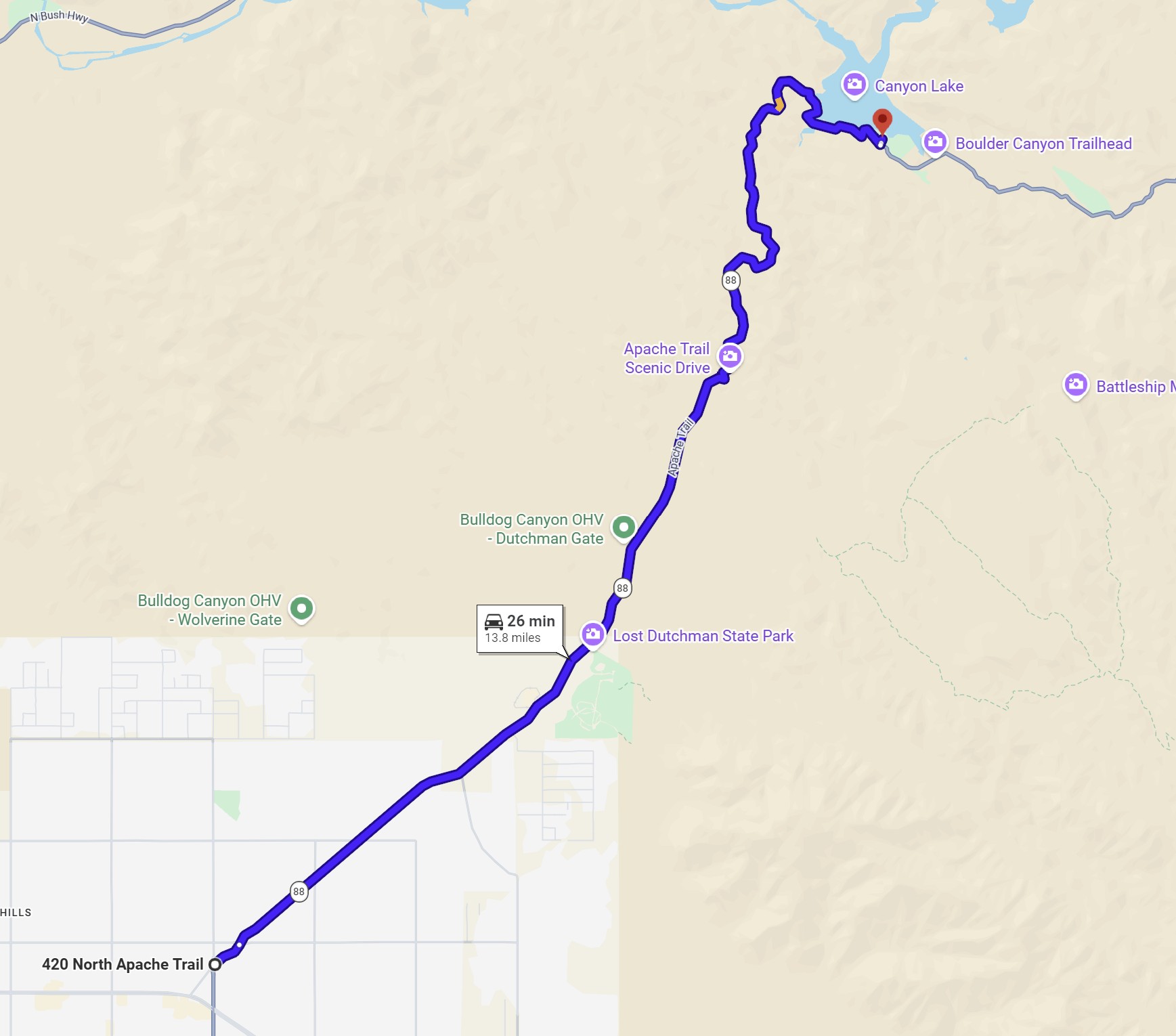
Canyon Lake event sites are located in the Tonto National Forest north-east of Apache Junction. The drive to the sites involves slow travel along the winding Apache Trail (AZ 88).
|
To get to the event sites:
|
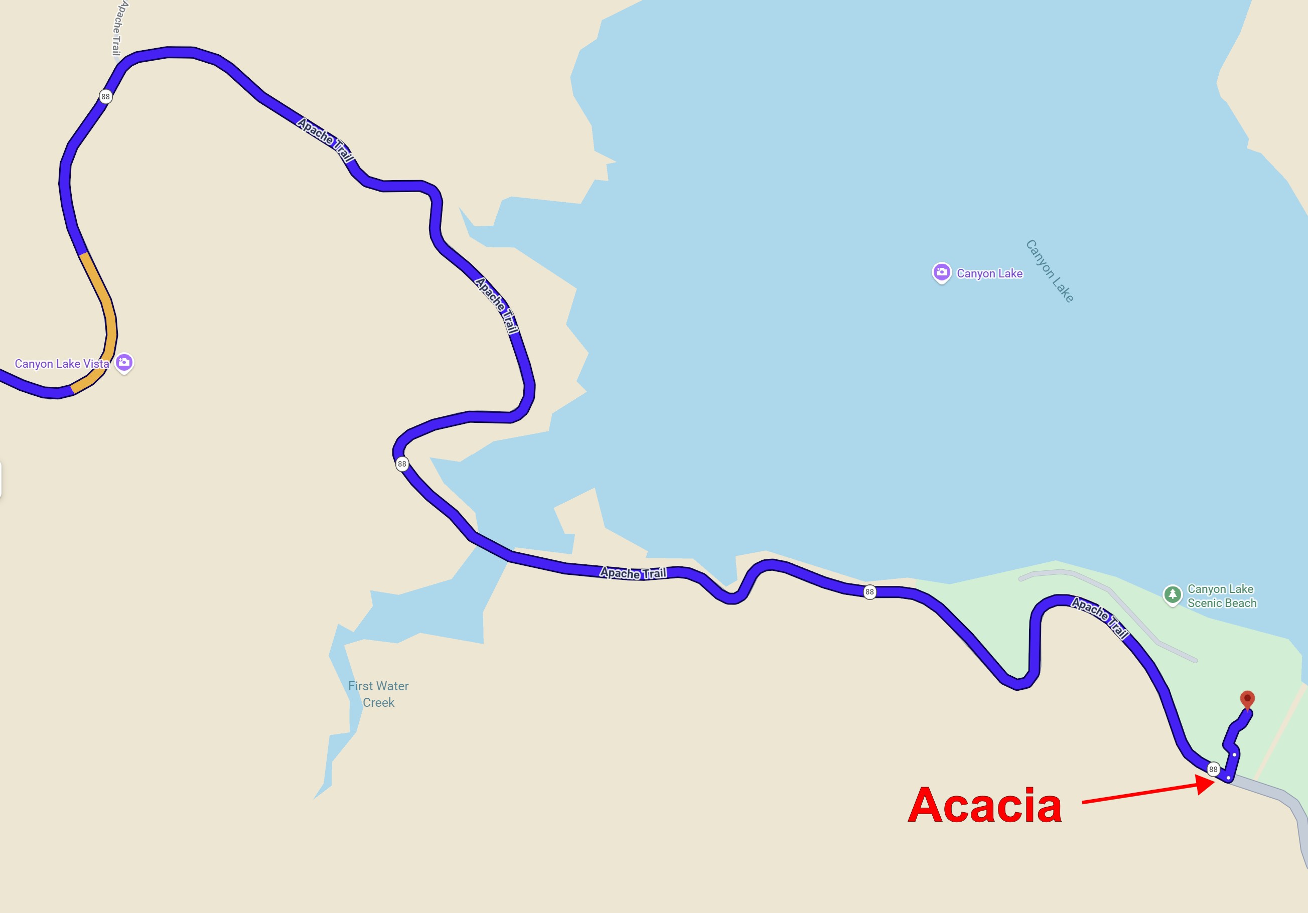
From Phoenix, take US 60 (Superstition Freeway) east to Apache Junction, exit at Idaho Road and turn left (north). When you reach the Apache Trail (Hwy 88), turn right. Drive about 14 miles NE along the windy Hwy 88 to the signed Acacia Recreation Site turnoff. Look for the orange and white orienteering signs.
|
Maps
Click on a map below to open an equivalent Google map in a separate window.
|
Map to Canyon Lake
|
|
|
Close-up of Acacia Parking
|
|